A Complete Route Guide
If you ask a dozen North Georgia riders to name the single road they’d hand to a first-time visitor, a lot of them land on the same answer: GA-348, the Richard B. Russell Scenic Highway. It’s tight, it’s remote, it climbs into genuine alpine air, and for a stretch of roughly 14 miles it asks more of you than almost anything else in the state. We’ve touched on it in passing in other route posts. It earns its own guide.
Here’s everything you need to ride it well.
The Quick Version
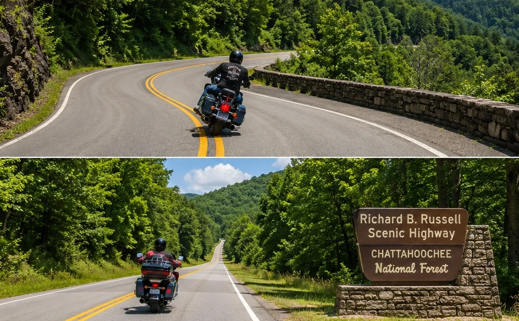
The Richard B. Russell Scenic Highway is the GA-348 portion of the larger Russell–Brasstown National Scenic Byway. The byway as a whole is a designated National Scenic Byway and runs a loop of about 40 miles through the Chattahoochee-Oconee National Forest. GA-348 itself is the headline act: a remote, heavily curved climb over the Blue Ridge that tops out near 3,600 feet at Hogpen Gap, with very little traffic thanks to how far it sits from anything.
It runs between Helen on the southeast end and Choestoe (near Blairsville) on the northwest end, where it meets GA-180. A common point of confusion, including in one of our own older posts: the road does not end in Dahlonega. Dahlonega is a fine ride in its own right, but it’s reached separately. GA-348’s western terminus is the GA-180 junction up near Brasstown Bald country.
Which Direction Should You Ride It?
This matters more than people expect, so it’s the first decision to make.
Southeast to northwest (Helen up toward Choestoe / Blairsville). This is the climbing direction. You start in the Helen area, turn onto GA-348 off GA-75 Alternate, and work your way up. The advantage is that you’re climbing into the tightest, most technical section rather than descending into it, which gives you more control and more time to read each corner. The payoff sequence builds nicely toward Hogpen Gap.
Northwest to southeast (Brasstown Bald area down to Helen). Riding it this way, you descend the relentless upper turns. It’s a thrill, but descending tight, off-camber mountain curves is less forgiving than climbing them, and you’ll be working your brakes hard the whole way down.
Our recommendation: ride it uphill, southeast to northwest, especially your first time. Save the descent for after you know where the corners go. And if you can, ride it on a weekday morning. Weekend traffic backing into Helen can cost you serious time, and a number of regulars deliberately approach from the north to avoid the Helen bottleneck altogether.
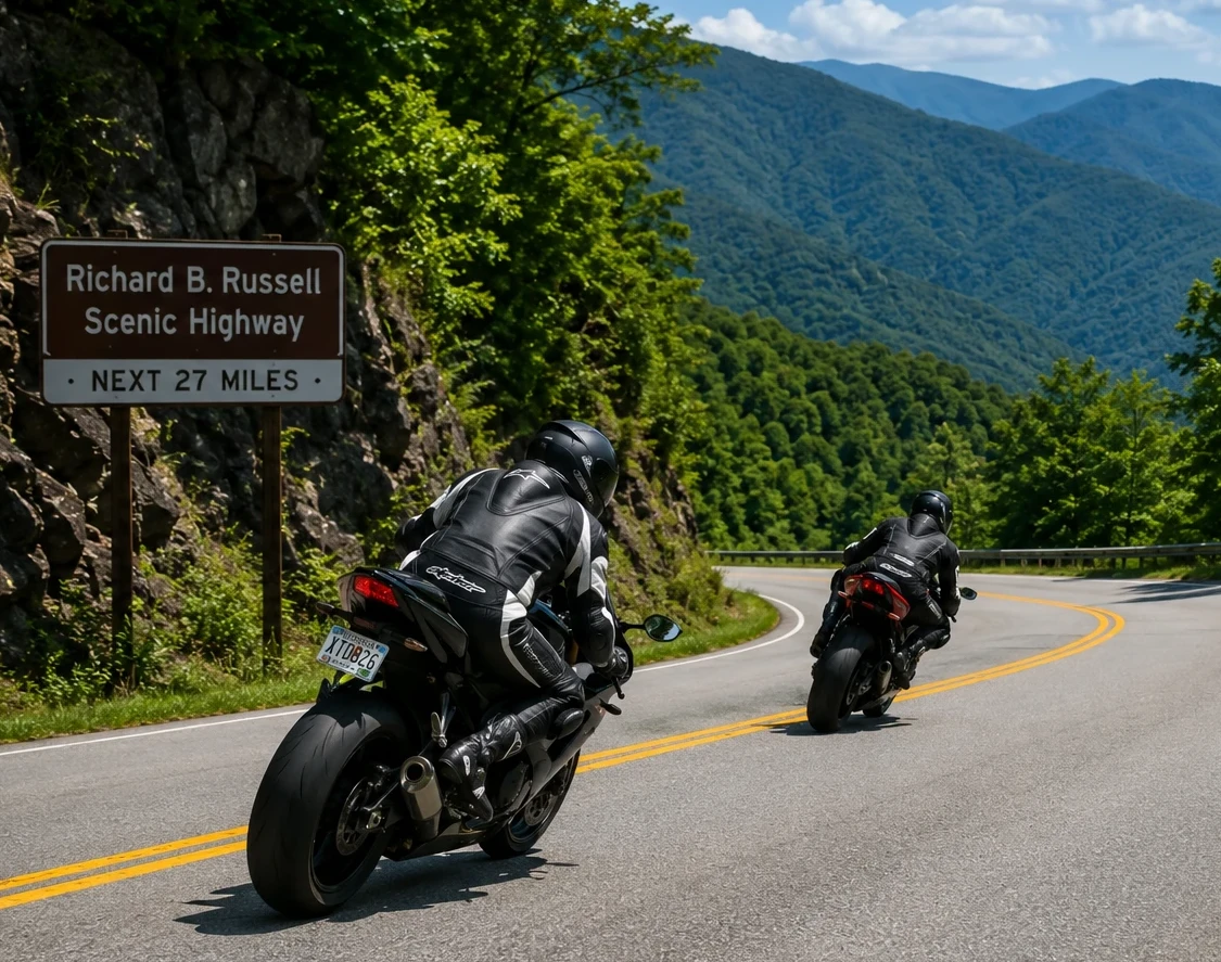
A Note Before You Commit: This Is a Technical Road
This is not a relaxed cruise with a pretty view. GA-348 is a genuinely demanding road, and going in with the right expectations is half of riding it safely.
Expect tight, frequent curves that rarely fully straighten out, real elevation change, camber shifts mid-corner, and blind bends with limited sightlines. The southern end in particular is known for gravel washing onto the road surface, so the first miles deserve extra caution. Add in that the pull-offs come up fast and aren’t well marked, and you have a road that rewards riders who are already comfortable with mountain technique.
If you’re newer to mountain riding, that’s not a reason to skip it, but it is a reason to ride it slow your first pass, in good weather, with no pressure to keep up with anyone. Our mountain riding pointers and lean angle posts are worth a read before you go.
The Ride, Stop by Stop
Starting from Helen
From downtown Helen, head north on GA-75, then onto GA-75 Alternate, and watch for the GA-348 turn. Almost immediately the road starts to climb and wind, and the traffic thins out fast as you leave the town behind and enter the national forest.
Dukes Creek Falls and Raven Cliff Falls
Within the first few miles you’ll pass the trailheads for two of the best short hikes on the route. Dukes Creek Falls is the shorter outing at roughly two miles round trip to a viewing platform. Raven Cliff Falls is longer, around five miles round trip, and many hikers think it’s the prettier of the two. Either makes a good leg-stretch if you want to turn the ride into a half-day.
Sunrise Grocery
A classic rider stop near the lower end of the corridor. It’s a small gift shop and country store, and the traditional move is to grab boiled peanuts or some beef jerky before you head up the mountain.
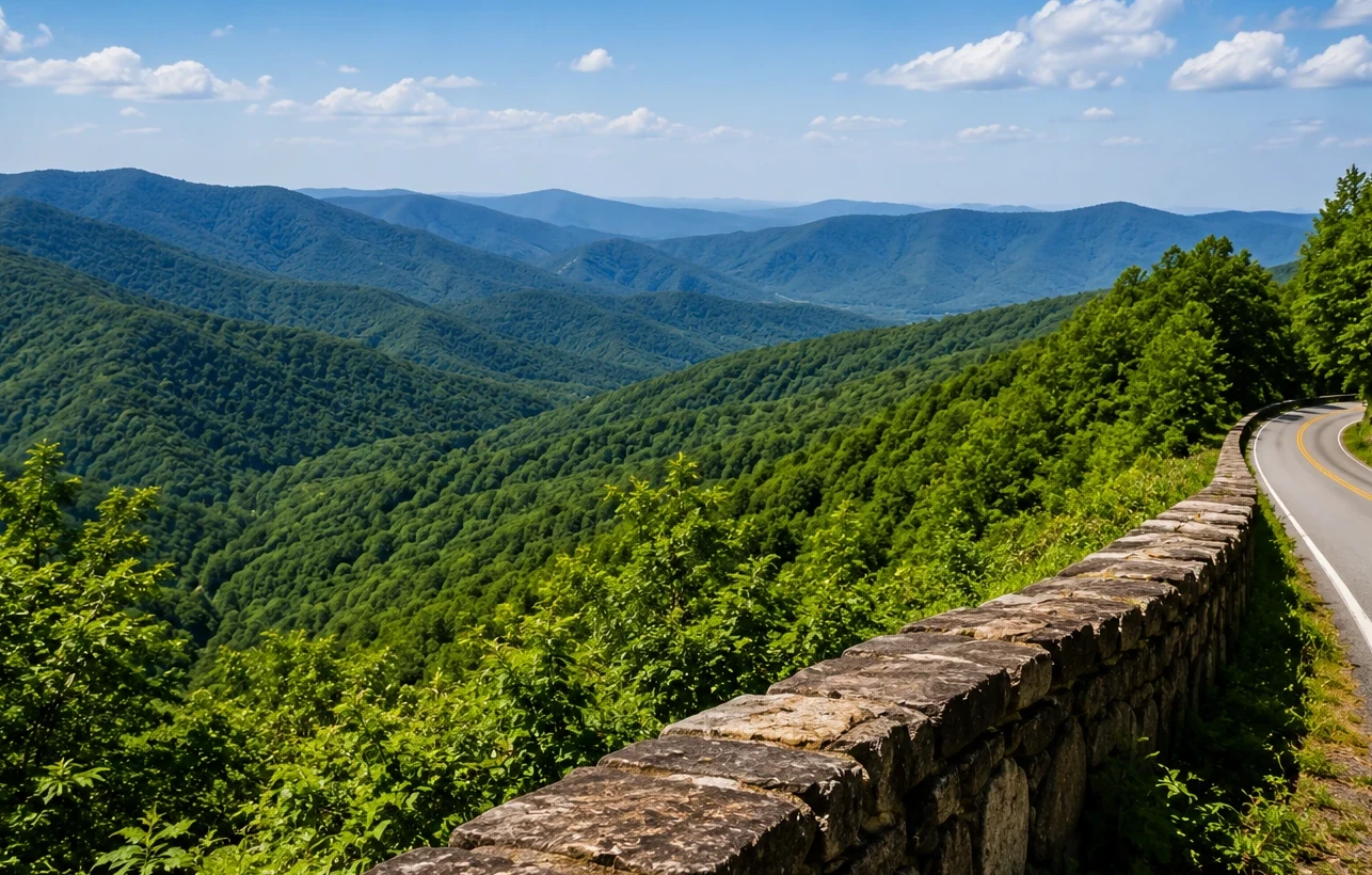
The Climb to Hogpen Gap
This is the heart of the road. The curves come one after another with little rest, the forest canopy closes in, and you climb steadily toward Hogpen Gap, the high point at about 3,600 feet. The Appalachian Trail crosses here, so you’ll often see thru-hikers, especially in spring. It’s a great place to pull off, eat something, and take in long-range mountain views. There are other pull-offs scattered along the way for photos, but remember the warning: they appear quickly and aren’t well signed, so don’t make sudden moves to reach one.
The GA-180 Junction
The GA-348 portion ends where it meets GA-180. This is your decision point for extending the ride, which is where the next two sections come in.
The Brasstown Bald Add-On
If you’ve come this far, the detour to Brasstown Bald is hard to pass up. It’s Georgia’s highest point at 4,784 feet, and it isn’t physically on GA-348, but it connects easily: from the GA-180 junction, follow GA-180 a short distance to the GA-180 Spur, which climbs to the visitor center parking area. The spur road is steep and twisty with a notably rough bump or two near the bottom, so take it easy.
From the parking lot you can hike roughly a half-mile to the summit or take the shuttle. At the top, the 360-degree observation deck gives you views into Tennessee and both Carolinas on a clear day. There’s typically a parking fee at the visitor center. It’s the single best panoramic payoff in the region and well worth building into the day.
Linking GA-348 With Wolf Pen Gap (GA-180) for a Full Loop
To turn the out-and-back into a proper loop, the move is to use GA-180 west, the stretch known to riders for the Wolf Pen Gap area, which carries on with the same twisty character past the GA-348 junction. From there you can drop down toward US-129 and the Vogel State Park area, then work your way back toward Helen via GA-75, closing a loop that strings together several of the best roads in this corner of the state.
Vogel State Park, one of Georgia’s oldest, makes a natural stop on the loop. It has restrooms, picnic areas, and a small lake, and it’s a good spot to regroup before the final leg. Riders also like Mountain Crossings at Walasi-Yi on the Blood Mountain stretch of US-129, where the Appalachian Trail passes right through the building and the patio overlook is a fine place to stand around and trade road stories.
Practical Notes
Fuel and food. There are essentially no services on GA-348 itself beyond Sunrise Grocery near the bottom. Fuel up and eat in Helen or Blairsville before you head into the mountains, and plan your range accordingly. Stations get sparse up here.
Cell service. Spotty to nonexistent along much of the route. Download offline maps before you leave, and don’t count on your phone for navigation once you’re in the forest.
Weather and elevation. It runs noticeably cooler at the top than down in Helen, and afternoon thunderstorms build fast in summer. Pack a layer and check the forecast. Wet leaves and that southern-end gravel make the road genuinely slick when conditions turn.
Watch for cyclists. This is a popular road-cycling area, and large organized rides come through in the warmer months, including events tied to the well-known Six Gap routes around Dahlonega. Give riders room, and expect company on nice weekends.
Best season. Fall is spectacular here and draws crowds for exactly that reason. Late spring and early fall weekdays tend to offer the best mix of good weather, open road, and manageable traffic.
The Bottom Line
GA-348 is the road that makes North Georgia’s reputation make sense. It’s short enough to ride in an afternoon, technical enough to keep you honest, and scenic enough that you’ll want to turn around and run it again. Pair it with the Brasstown Bald climb and a GA-180 loop and you’ve got one of the finest day rides in the Southeast.
Ride it uphill, ride it on a quiet morning, keep an eye out for gravel and cyclists, and give the mountain the respect it asks for. It’ll give plenty back.
Have you ridden GA-348? Drop your favorite overlook or your go-to direction in the comments.